ETH Bibliothek, Image Archive
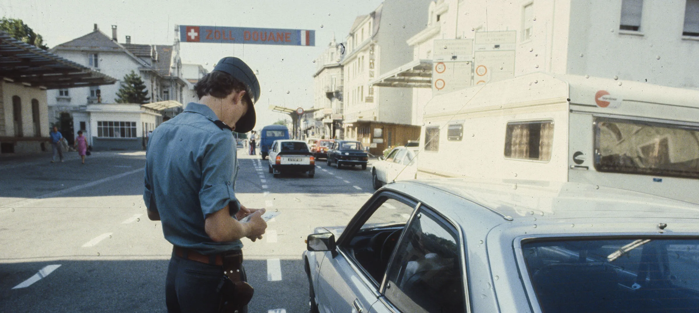
Switzerland – a land of borders
Since ancient times, people’s everyday lives have been shaped by intangible dividing lines. Consciously or unconsciously, these lines are constantly being crossed.

Bernhard Graf
Bernhard Graf is a cultural mediator and has been living in Ticino for many years.
Like every other country, Switzerland is enclosed within its national borders, in which breaks of all kinds appear: the size and shape of windows changes, the language and lettering on signposts is different from one place to the next, meal times are shifted, and in the countryside bakeries are even open on Sundays... But national borders can also be lines of division, across which natives and foreigners stare uncomprehendingly at one another, cultural differences seem insurmountable and – at worst – wars are sparked. Borders must be made visible in one form or another. This is done using, for instance, stones or posts featuring the national emblems of the peoples whose territories meet at the border. There are always at least two neighbours involved, but sometimes three or four.
It often happens that one of the neighbours changes its name, or enters into a new (forced) marriage. Alsace, which borders Switzerland, is a good illustration of this, having been part of one or other of its neighbours on the Upper Rhine on a number of occasions over the past 400 years.
In 1648 it was unceremoniously incorporated into the kingdom of France under Louis XIV; Germany recaptured it in 1871, and since 1919 it has once again belonged to France. Each time, the region’s new territorial status had to be made visible along its border with either the confederate states or Switzerland, depending on the time period. On the relevant boundary stones from Basel to Kleinlützel in the Jura, however, no changes needed to be made on the Swiss side of the stones even when the Canton of Basel was split into two half-cantons in 1833. From then on, anyone who came across the black ‘Baselstab’ needed to know only that it now represented only the urban section of old Basel...
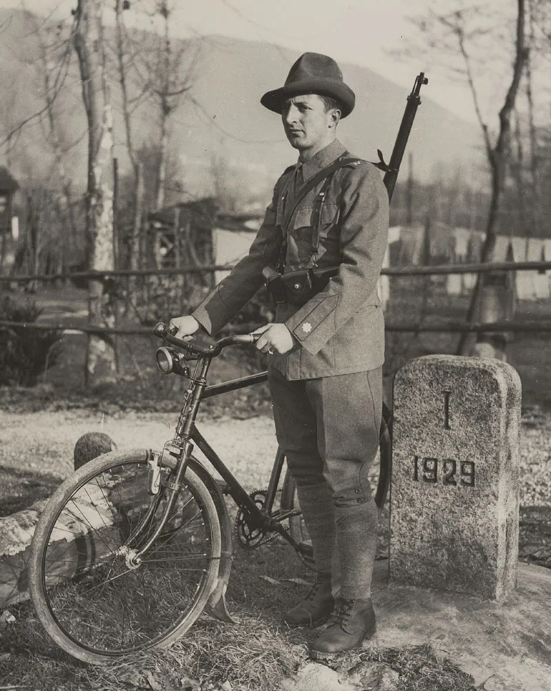
Boundary stone dating from 1929.
Swiss National Museum
WHEN BORDERS ARE DRAWN ON A DESK...
The more recently a border demarcation was brought in, the more easily it can be explained how it came about. In 1952 the border between the urban municipality of Basel and the municipality of Riehen was slightly adjusted by mutual consent, for purely practical reasons, while maintaining the area of the two territories. Sometimes the course a border takes has a very simple geographical explanation. East of Lucelle in the Canton of Jura, the border follows the twisting course of the Lützel river, which the road, built in the 19th century, ignores, consequently crossing to the opposite bank – and thus leaving the country! – several times.
Borders have also been drawn at desks and directly onto the map, where regions or even continents have been subdivided administratively; there are examples of this in the USA and the Middle East, for example, where these borders can be identified by their dead-straight lines. As far as Switzerland is concerned, the reasons for the course of the border go far back into history. Property ownership, on both a small and a large scale, is the origin of many border demarcations, and frequently this may be connected with a denominational affiliation that divides a region. The Appenzell canton division of 1597 was preceded by the Reformation; its effect was the creation of the reformed part of the canton, Ausserrhoden, with the Catholics remaining in Innerrhoden.
In southern Switzerland, the Italian enclave of Campione was created in 1803 at the request of its inhabitants who wished, despite the formation of the Canton of Ticino, to retain the region’s centuries-old link to Como, which had existed since land was endowed to the Bishop of Como by a Campione resident in the 9th century AD. By the way, it wasn’t until 1933 that the ‘d’Italia’ was added to the name Campione, by Italian Prime Minister Benito Mussolini; it was also he who openly proclaimed that Italy actually borders Switzerland on the Gotthard Pass.
The territory of Campione was larger until 1861, extending to the opposite lake shore at the foot of Monte San Salvatore. Anyone using the road from Lugano south towards Melide thus had to cross Italian territory. Until 1804, ‘la forca’ – the gallows – of Lugano stood there in clear view. Today, however, tourists enjoy the stunning view over the lake eastwards to Porlezza in Italy. They’ve come by car, avoiding the danger of the heavy traffic against which Karl Baedeker was already warning those travelling on foot as early as 1927.
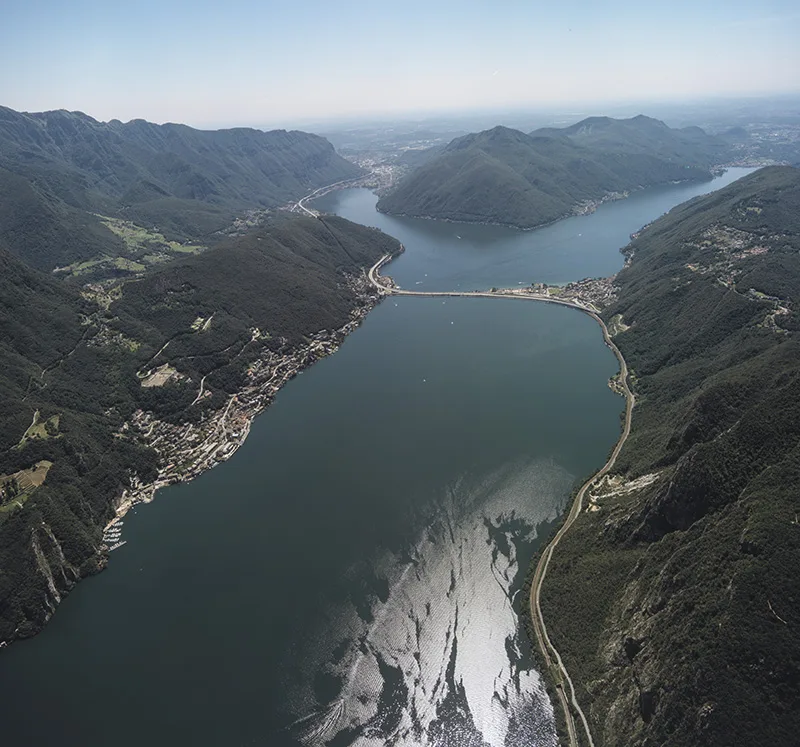
Campione d’Italia (left), taken in 1997.
ETH Bibliothek, Image Archive
HABSBURGS WANTED TO KEEP HOLD OF A VILLAGE
The German enclave of Büsingen is encircled by the Cantons of Schaffhausen and Thurgau – a state of affairs that dates to the not entirely successful Schaffhausen repurchase in 1723 of villages lost to Austria, in the course of which the Habsburg empire wanted to keep hold of this community – unlike others in the surrounding area. The territories remaining with Austria came to Germany in 1805, and as a result the treaty with Switzerland, which governs all details concerning Büsingen, was signed by the government in Bonn in 1967.
In many cases, borders that are valid today were drawn in the Middle Ages or even earlier. But even in the 20th century, new borders have come into being – associated with the secession of the Jura region of Bern canton and in its aftermath. So, when hiking in the Laufental you can still find boundary stones showing the Bernese bear emblem, even though the area has belonged to the Canton of Basel Landschaft since 1994.
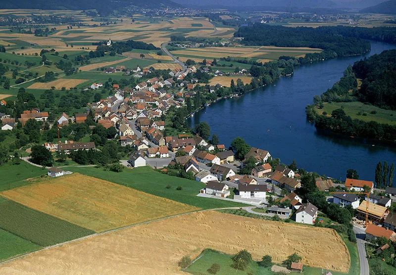
The German enclave of Büsingen near Schaffhausen.
ETH Bibliothek, Image Archive
LANGUAGE BORDERS AND WORD IMMIGRANTS
Languages also have their territories, and consequently there are language boundaries; word immigrants are known as foreign words. The origins of these words aren’t always immediately recognisable, as in the case of the word Grenz, which at first glance sounds very German. But appearances are deceptive! The word is an import from Polish, where it is originally ‘granica’ with the same meaning. As long ago as the early Middle Ages, it made its way westwards as an import brought by Germans returning home from north-eastern Europe.
Looking in the opposite direction, traces of border settings can be found in our language: the Roman fort of Ad Fines (Pfyn, Thurgau), the river Murg in Frauenfeld, the March District in the Canton of Schwyz and the town of Murg am Walensee are strung out along the border between the Roman province of Maxima Saequanorum (in the west) and Raetia (in the east). The three names mean ‘end’ (Ad Fines) or ‘border’ (March, Murg).