One of the greatest natural disasters in Swiss history: in 1806, a landslide triggered a giant wave in Lake Lauerz.
One of the greatest natural disasters in Swiss history: in 1806, a landslide triggered a giant wave in Lake Lauerz. © The Trustees of the British Museum

Tsunamis on Lake Lucerne

Switzerland’s first-ever tsunami hazard map was created for the canton of Nidwalden in 2015. How did this come about?

Noah Businger

Noah Businger

Noah Businger is a historian and a PhD student in Early Modern Swiss History at the University of Bern.

The authorities in Nidwalden are preparing for a tsunami. Together with researchers from the University of Bern and ETH Zurich, they have extended the canton’s water hazard map to include the potential impact of giant waves. Specialists in the field spent many months painstakingly modelling possible tsunami waves on Lake Lucerne and quantifying their destructive potential along with the threat posed to people.
 
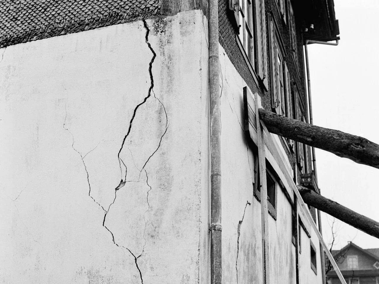
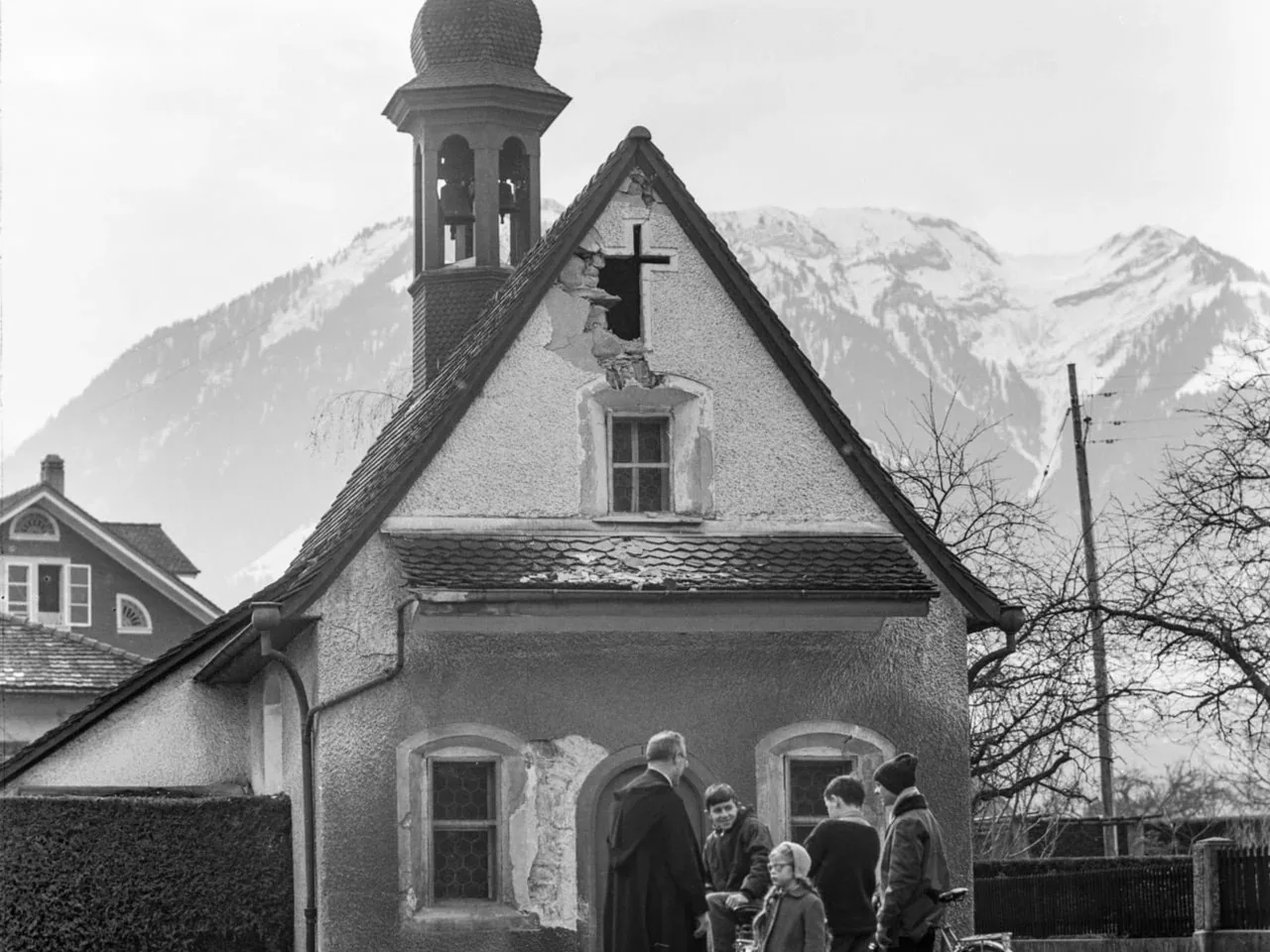
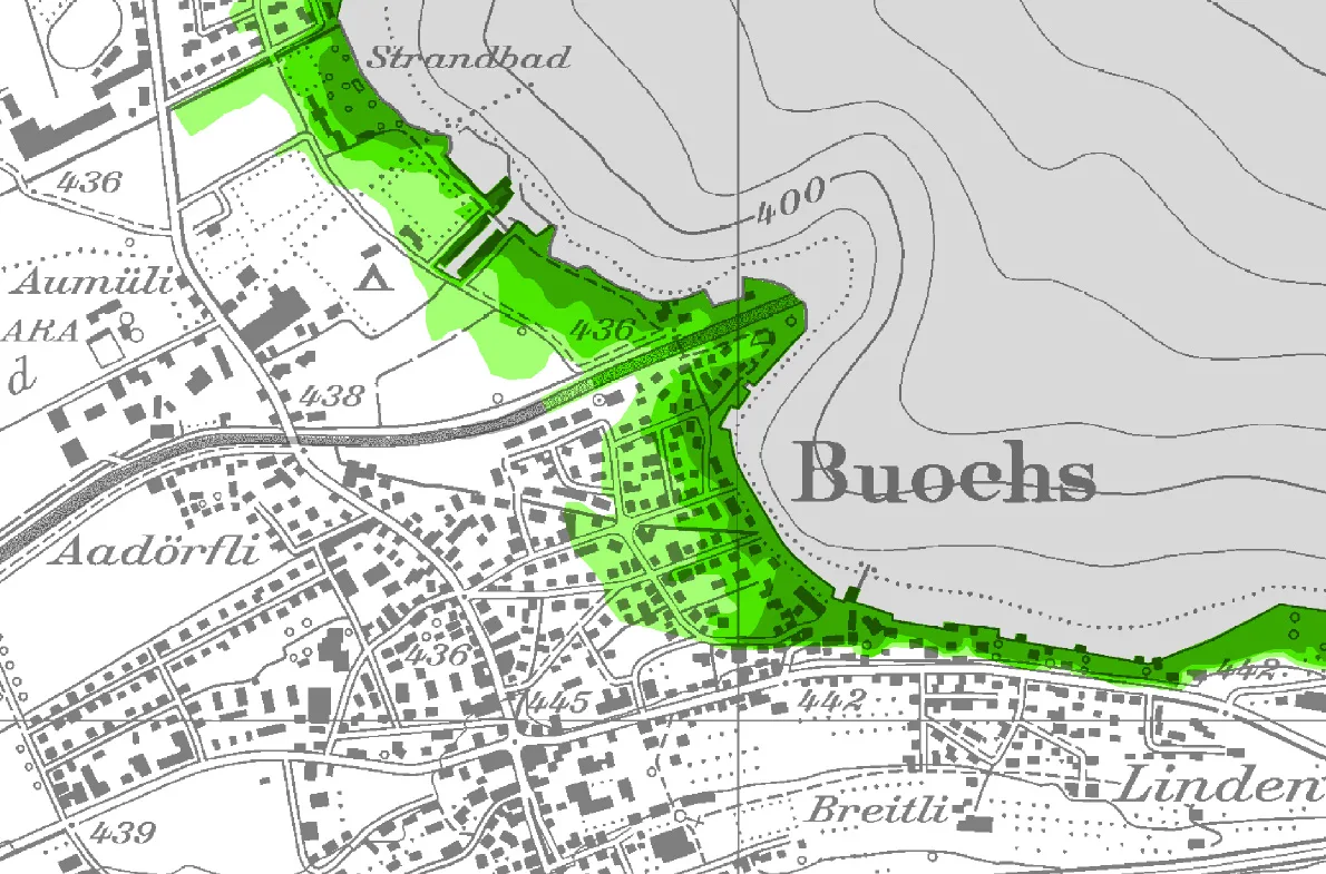
The extensive work involved was entirely justified: the results of the calculations and analyses show that the danger is real. A tsunami wave engulfing the shores of Nidwalden, travelling several hundred metres inland and causing considerable damage is a plausible scenario.
If there were a tsunami, the village of Buochs would be inundated. The darker the green, the greater the intensity of the flood wave.
If there were a tsunami, the village of Buochs would be inundated. The darker the green, the greater the intensity of the flood wave. Canton Nidwalden, map of flood wave intensity
But what made the cantonal authorities even think about making these calculations in the first place? Most people in Switzerland associate tsunamis with the world’s oceans and with areas that are highly prone to earthquakes, not with perialpine lakes. As is so often the case, the answer lies in the region’s past: a devastating tsunami occurred on Lake Lucerne 500 years ago.

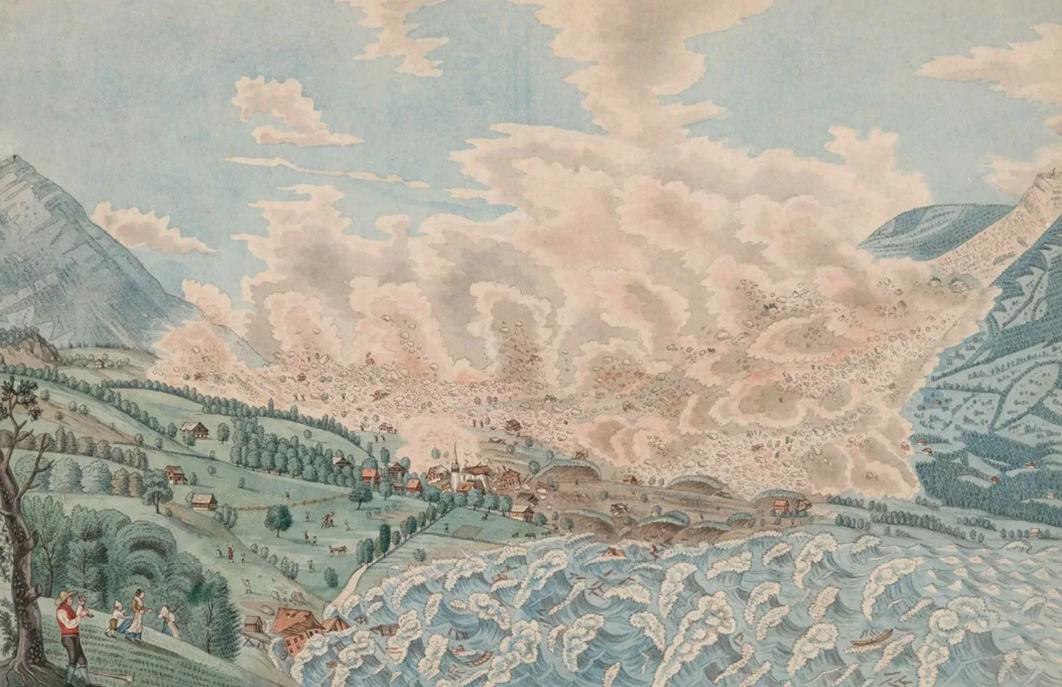
Renward Cysat was shaken to the core

At 1 o’clock in the morning of 18 September 1601, the earth trembled. With its epicentre located close to the Stanserhorn mountain and a (reconstructed) magnitude of 5.9, the quake violently shook the whole of Central Switzerland. Trees and houses were uprooted, mountainsides crumbled.

A savage tumult and commotion accompanied by rumbling and roaring, almost as if half-a-dozen strong men had fallen upon one another, delivering strikes and blows, wrestling and sparring, and were thus being hurled to and fro across the chamber

Description of the 1601 earthquake by Renward Cysat
Details of the earthquake were recorded by Renward Cysat (1545–1614), Lucerne’s city chancellor and chronicler, who happened to be staying in nearby Goldau at the time. He made his way back to Lucerne the next day, riding along the lakeside. At Küssnacht he saw boats that “were cast upon the strand, a good 50 paces back from the accustomed shore, and at a height of two halberds or more above the water’s edge”. Not only had the boats run aground, they lay as much as two ‘halberds’ – roughly four metres – above the normal waterline.
 
On reaching Lucerne, Cysat was told how the water in the Reuss river had repeatedly been drawn right back into the lake only to suddenly come rushing back out again into the riverbed. We can recognise this description as what we would now call a ‘seiche’, where all the water oscillates back and forth from one side of the lake to the other. The surface of the lake becomes tilted and the water sloshes to and fro. Viewed from the bank, the lake appears to retreat from the shore for a few hours, only to come thundering back as giant, metre-high waves.
Following an earthquake, underwater landslides can trigger seiches. That was what happened on Lake Lucerne in 1601. The huge seismic waves directly after the quake caused major oscillations in the lake's water levels.
Following an earthquake, underwater landslides can trigger seiches. That was what happened on Lake Lucerne in 1601. The huge seismic waves directly after the quake caused major oscillations in the lake's water levels. Modified illustration by Zafar et al. 2025
In 1601, this phenomenon caused waves that penetrated as far as 500 to 1,000 metres inland in Ennetbürgen. And they were destructive: at least ten people lost their lives to the water.
 
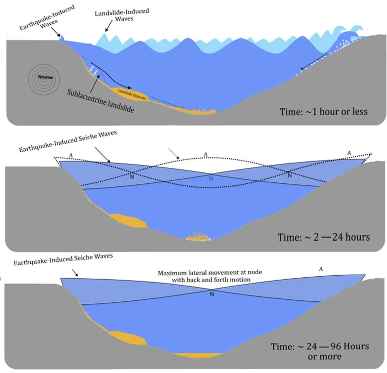
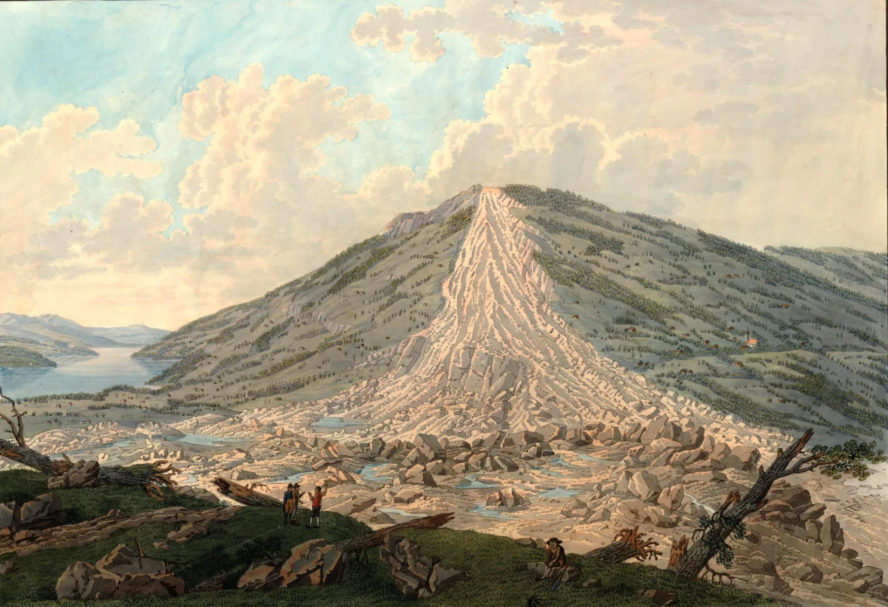
Those gigantic flood waves were not triggered directly by the earthquake. The tsunami was caused by what are known as underwater sediment avalanches. The earthquake caused gigantic masses of mud and rock deposits to break away from the sublacustrine slopes. Much like a slab of snow, this sediment avalanche slid down over a less cohesive weak layer towards the lakebed. As it fell the material pushed the water upwards, and the rising column of water triggered a tsunami wave on the surface. In 1601 that generated waves up to ten metres high, which barely lost any of their force as they travelled, thus creating the seiches.

Consequences, then and now

The quake and the tsunami were catastrophic, claiming lives, destroying infrastructure and leaving society demoralised. The authorities in Lucerne saw the earthquake as a punishment sent by God. Consequently, two days after the terrible events, the governing council banned any excessive feasting and celebrating for several months.

And in light of the weight and multitude of our sins, God Almighty hath visited a terrible earthquake upon us this past Monday night. Therefore have my Gracious Lords of the city and country, upon pain of severe punishment, caused all dancing, gaming, and unnecessary feasting to be struck down and forbidden; likewise all shouting, tumult, singing, and the playing of stringed instruments, even until Carnival.

Minutes of the Executive Council of Lucerne, 20 September 1601
These days, our attitude to tsunamis on Lake Lucerne is more profane, with insurance cover for potential damage the main focus. The Swiss Pool for Earthquake Insurance has calculated that an event like that of 1601 would cause the equivalent of up to CHF 9 billion in building damage today.
Visualisation of the 1601 inundation in the current-day environment of Ennetbürgen/Buochs.
Visualisation of the 1601 inundation in the current-day environment of Ennetbürgen/Buochs. Anselmetti/Hilbe 2016
Nidwalden is at particularly high risk. The lake basin at Buochs harbours ideal geological conditions for high impact waves to occur. Towering tsunami waves could rise up at the flat delta of the Engelberger Aa river and penetrate deep inland. In addition, many of the slopes surrounding the basin continue for 200 metres underwater; large amounts of material capable of generating a huge sediment avalanche could build up here. And, as is the case elsewhere around Lake Lucerne, the ongoing construction boom by the waterfront at Buochs has significantly increased the potential for damage.

But the scientific studies also suggest that we shouldn’t start panicking just yet. An event like that of 1601 is unlikely to happen again so quickly. Back then, so much material slid from the submerged slopes that it will be centuries before similar deposits can build back up again.
 
Nevertheless, tsunamis on Lake Lucerne remain a possibility. Two examples from the region show that there is no lack of potential triggers.

Landslides as a tsunami trigger

In 1806 there was a major landslide on the Rossberg mountain above Goldau. More than 30 million cubic metres of rock came roaring down and destroyed the village. The landslide also triggered a tsunami on nearby Lake Lauerz. The streams of debris came tumbling down onto the moorland bordering the lake and the force of the landslide abruptly pushed this landmass before it into the lake. It was this movement that gave rise to a flood wave several metres high.
16-year-old David Alois Schmid saw the Goldau landslide with his own eyes and subsequently portrayed it in pictorial form. Schmid depicted how the swampy Sägel area situated on the opposite side of the lake, between the landslide area and the shore, rose up as tall as a house and was pushed towards the lake.
16-year-old David Alois Schmid saw the Goldau landslide with his own eyes and subsequently portrayed it in pictorial form. Schmid depicted how the swampy Sägel area situated on the opposite side of the lake, between the landslide area and the shore, rose up as tall as a house and was pushed towards the lake. © Foto: SKKG 2025, CC BY 4.0
Lake Lucerne is surrounded on all sides by steep mountains. Landslides could also occur there, generating a tsunami wave like the one on Lake Lauerz. But an event similar to that of 1601 would first require underwater sediment avalanches to be triggered by a strong earthquake. And quakes are not uncommon in Central Switzerland.

The next flood wave will come

The last major earth tremor in Central Switzerland was recorded in Obwalden in 1964. A series of earthquakes in February and March of that year culminated in a tremor with a magnitude of 5.3. The event hit the towns of Sarnen and Kerns hardest, with barely a house left unscathed. Although there were no deaths or serious casualties, fears of an even stronger earthquake took hold.
A damaged house in Kerns and the damaged St. Antonia Chapel in Sarnen, March 1964.
A damaged house in Kerns and the damaged St. Antonia Chapel in Sarnen, March 1964. Keystone / Keystone
This seismic activity occurred at a similar location as in 1601 and with just as much energy. But instead of sediment avalanches and flood waves, it only caused tears in the fabric of buildings and triggered fear among the general public. Yet the region’s history and geology show that another tsunami on Lake Lucerne cannot be ruled out – the question is not if, but when.

Further posts