Work was still ongoing in Aarberg long after Napoleon had been defeated and the threat of a French attack had been averted. Illustration by Marco Heer.

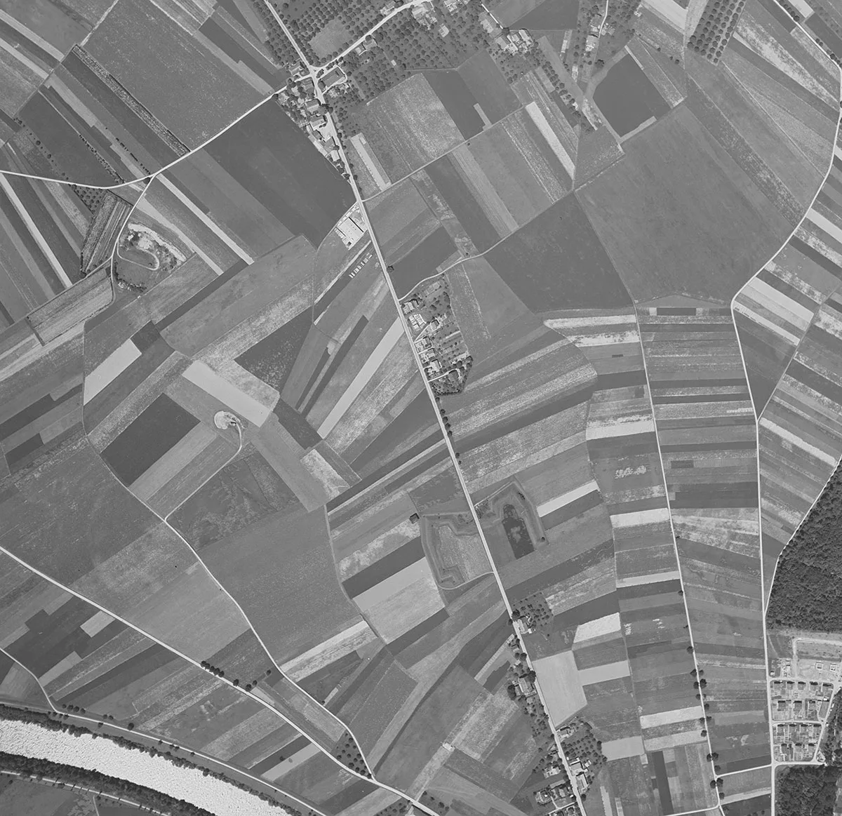
Defending Switzerland against attacks that never happened

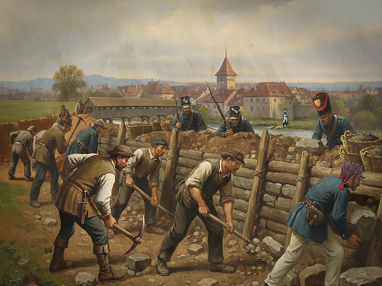
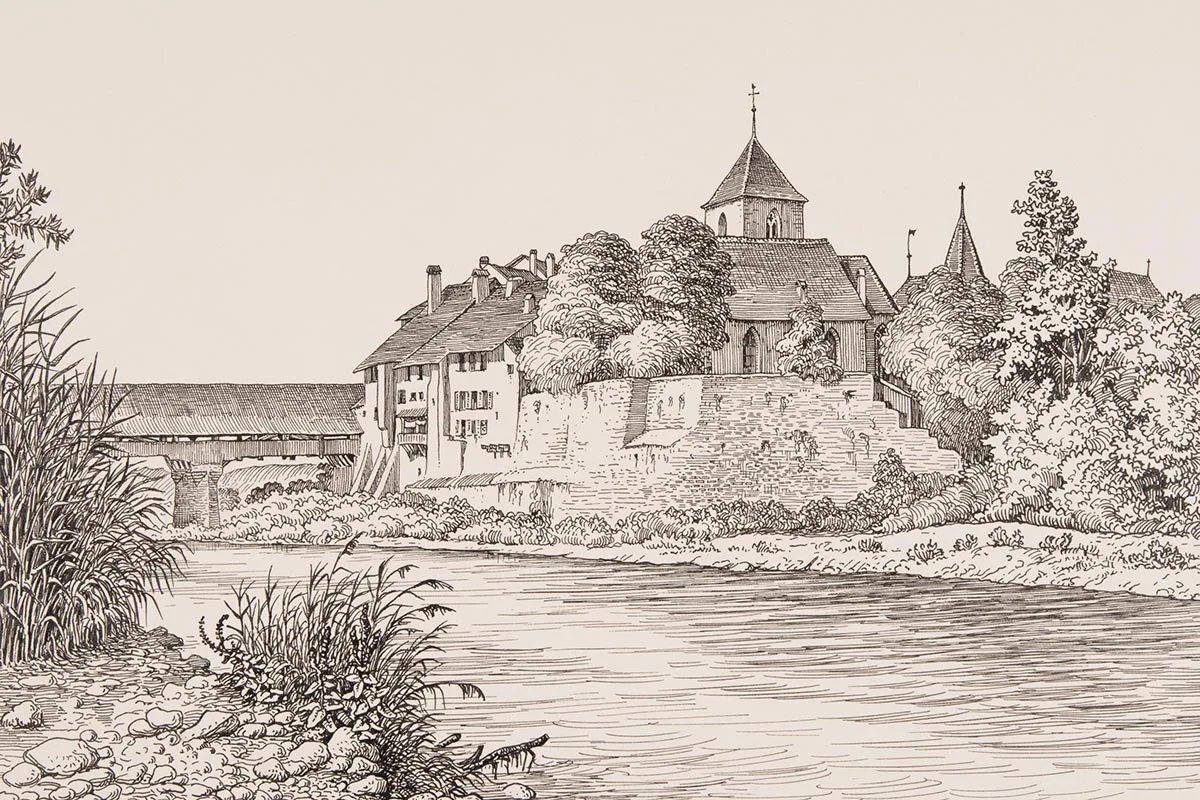
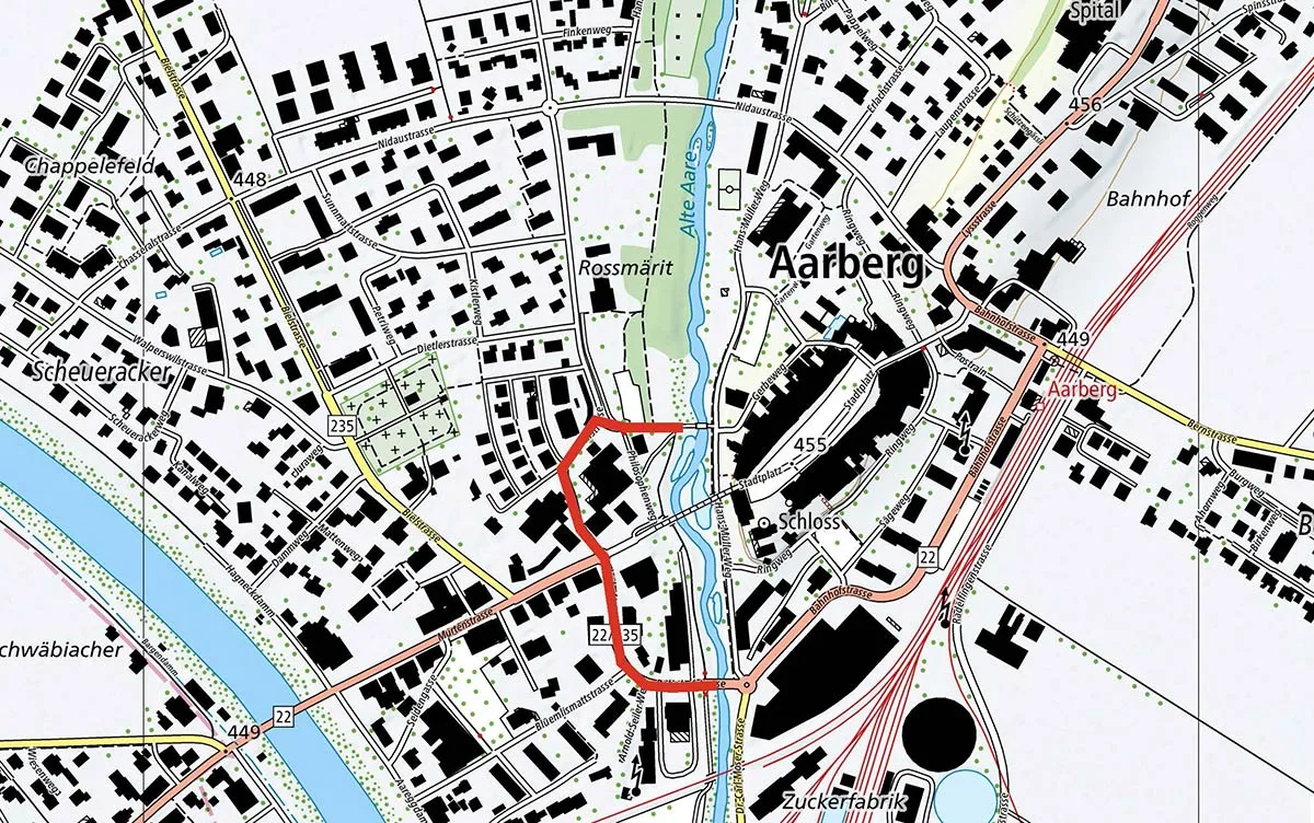
In the early 19th century, Switzerland was traumatised by the French invasion of 1798 and there were fears that France would attack again. In Switzerland’s defence planning, Aarberg was a strategic military location as French armies could potentially cross the River Aare there. An obstacle was therefore needed.
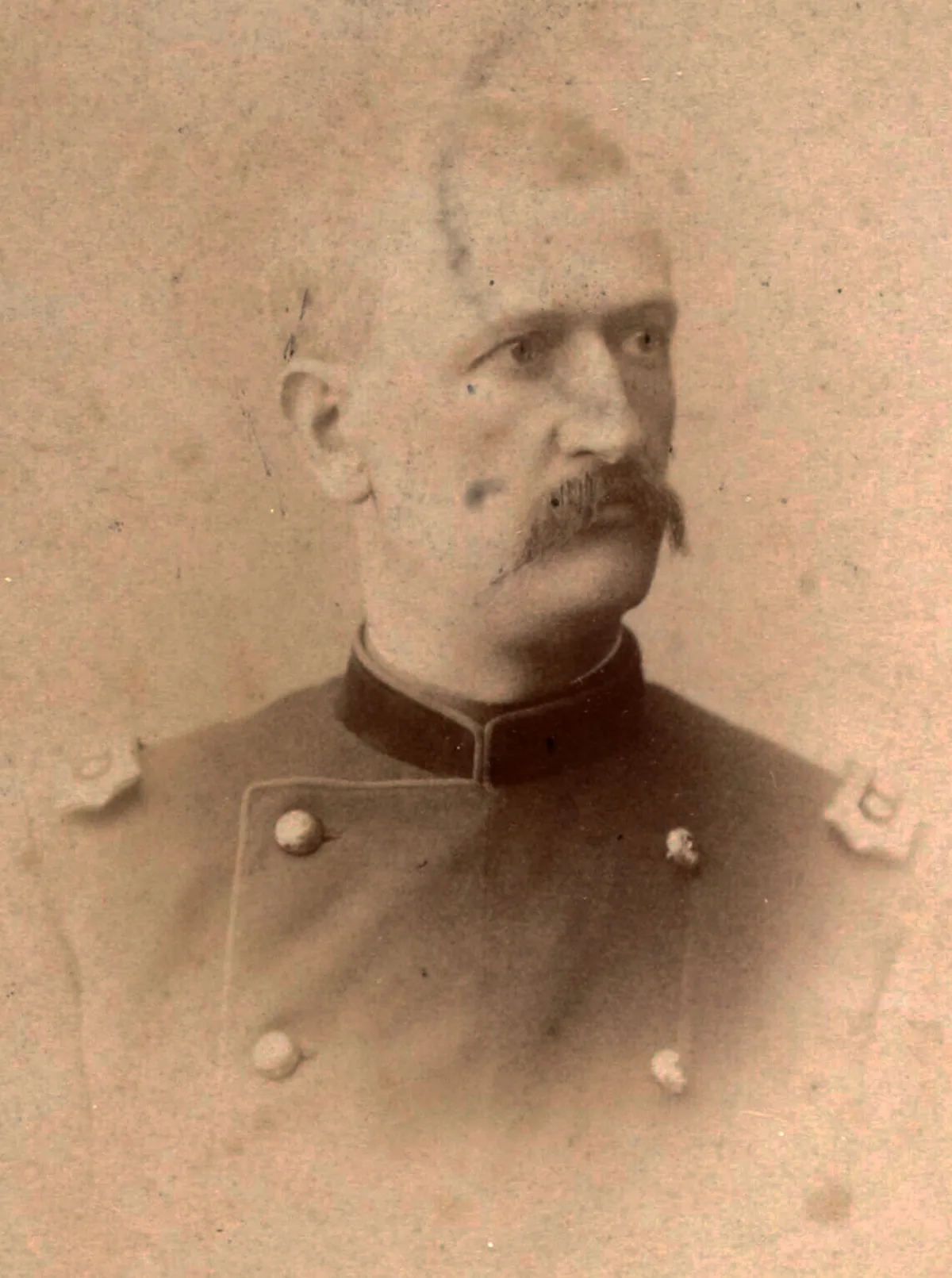
Juri Jaquemet

Juri Jaquemet

Dr. phil., Curator of the Information and Communication Technology Collection, Museum of Communication, Berne

The Congress of Vienna, which started in the autumn of 1814, set out the new European order following the Napoleonic wars. While the delegations were seeking restoration, in March 1815 Napoleon Bonaparte made a surprise return from exile to France.
Switzerland feared a repeat of the invasion of 1798, and even in Vienna there was growing unease about the situation. The Congress of Vienna hastily recognised that Switzerland’s perpetual neutrality was also in the interests of the common good. In 1815, the Swiss Federal Diet appointed Niklaus Franz von Bachmann (1740–1831) as supreme commander of the federal troops. Bachmann was responsible for Switzerland’s defence during the Hundred Days of Napoleon’s rule. In the spring of 1815, however, the Swiss Army was not yet fully fledged.
Niklaus Franz von Bachmann depicted by Felix Maria Diogg, 1817.
Niklaus Franz von Bachmann depicted by Felix Maria Diogg, 1817. Swiss National Museum
In the 19th century, political and military relations with France were still shaped by mutual mistrust. In northwestern Switzerland, the Jura mountains formed a natural border with France. Further inland, however, the plains of the Bernese Mittelland formed a transit corridor from Geneva to the north-east, where towns and cities like Solothurn, Olten and Zurich were located.
Where the wooded Alpine foothills approached the Jura and significantly narrowed the transit corridor, the area was similar to a mountain pass. This was the case between the Frienisberg and Lake Biel or the Jura, for example. This passage was intersected by the Jura lakes, the Grosse Moos – which at the time was still marshy –, and the line between the River Aare and the River Saane. This area formed a natural barrier located deep within the country against attacks from France.

The Aarberg choke point

As the only route through this pass-like terrain, Aarberg, with its covered wooden bridge over the Aare, was a choke point. The roads from Neuchâtel, Murten and Biel converged just outside the small town. Nowadays it is often forgotten that before the correction of the waters of the Swiss Jura and the construction of the Hagneck canal, Biel was located to the west of the Aare. To travel from Biel to Bern, you had to cross the Aare, either in Aarberg or in Büren. In the event of an attack from France, the chances were therefore high that hostile armies would try to make it to the other side of the Aare in Aarberg.
Drawing of the town of Aarberg by Roland Anheisser, early 20th century.
Drawing of the town of Aarberg by Roland Anheisser, early 20th century. Swiss National Museum
Concerned about Napoleon’s return, the Swiss Federal Diet decided on a partial mobilisation in March 1815, with some of the federal troops deployed to guard the border between Basel and Geneva. The supreme commander Bachmann, who had acquired a wealth of military experience while serving abroad, did not focus the defence only on the immediate vicinity of the border. He also deployed his army to take up a central stand-by position between Lake Neuchâtel, Solothurn and Aarberg.
If France did attack, Bachmann reckoned that he would have to surrender the Jura. He therefore intended to withdraw the army to the eastern bank of the Aare when the time came. A retreat to the other side of the Aare would have been risky for the withdrawing Swiss troops, however. Crossing the river while being pursued could have resulted in heavy losses. For this reason, fortified bridgeheads were designed to accommodate soldiers on the western bank of the Aare and provide cover for them as they crossed the river.
The Swiss feared the return of Napoleon Bonaparte in 1815 and reacted accordingly. Lithograph by Auguste Raffet.
The Swiss feared the return of Napoleon Bonaparte in 1815 and reacted accordingly. Lithograph by Auguste Raffet. Wikimedia / Los Angeles County Museum of Art
The small town of Aarberg was well protected on an island in the River Aare. But as the old town centre could not be used as a redoubt to protect the bridge, Bachmann ordered the construction of a bridgehead on 4 June 1815. The structure was to be able to accommodate 2,000 men. Management of the construction was entrusted to engineer officer Karl von Bonstetten (1788–1822), who had previously carried out a reconnaissance mission on both banks of the Aare with lieutenant colonel Johann Ludwig Wurstemberger (1783–1862). Bonstetten created a simple tenaille that was capable of self-flanking at right angles. The construction had the advantage that it made it very difficult to fire at one’s own troops. With other types of fortifications, there was always a fear that poorly trained soldiers could cause accidents during friendly fire.

Bad timing

Engineers, soldiers from battalions stationed nearby, and civilians set to work on the construction. The work proceeded slowly as it coincided with a period of bad weather. The soldiers, who were constantly soaked through as they worked and were accommodated in damp field barracks, were at risk of becoming unfit for duty after two weeks. The bad weather and manpower shortages delayed the work for so long that the fortification was only completed in late July 1815, following a construction period of 60 days. This was a phenomenon that was to be repeated several times in the history of Swiss fortifications: the structure in Aarberg was only completed once the risk had been averted. This was because Napoleon had been practically annihilated at the famous battle in Waterloo, south of Brussels on 18 June 1815. Bachmann had also ordered the construction of bridgeheads in Nidau and Büren an der Aare. At the end of June 1815, the fortification in Nidau was merely staked out in the ground; the construction had not yet got under way. And in Büren, the planning was not even at that stage.
The Aarberg fortification line marked in red. The bridgehead can no longer be seen today as it was dismantled in the 19th century.
The Aarberg fortification line marked in red. The bridgehead can no longer be seen today as it was dismantled in the 19th century. Map: swisstopo, annotation: Juri Jaquemet
The Aarberg bridgehead was located on the western bank of the Aare, directly in front of the wooden bridge. The roads from Murten, Neuchâtel and Biel converged immediately in front of the ditch and parapet. The breastwork, around 450 metres in length, formed a symmetrical tenaille. The Aare formed the gorge or rear of the work and was a storm-proof barrier. In the event of war, cannons on the eastern bank would have been able to deliver powerful flanking fire. The defence structure itself could also be equipped with up to 15 cannons. The interior of the fortification provided cover from advancing enemies.
After the troops were demobilised, the Swiss Confederation acquired the site near Aarberg. The Bern cantonal authorities were responsible for maintaining the structure. The Confederation was thrifty in its approach to the acquisition, only purchasing the narrow strip of land where the ditch and parapet stood. These expropriations cost 11,000 Swiss francs (around one million today). Thanks to the acquisition of the strip of land by the Confederation, the bridgehead in Aarberg can be considered the first ever Swiss fortification.
Map of the ‘first Swiss fortification’ in Aarberg, 1815.
Map of the ‘first Swiss fortification’ in Aarberg, 1815. Swiss Federal Archives

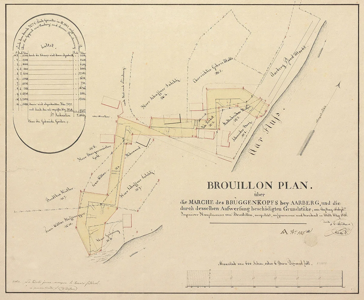
Aarberg played a key role again in 1831

The July Revolution of 1830 in Paris prompted the Swiss Federal Diet to issue a declaration of neutrality and to start preparing for mobilisation. To this end the Diet deployed General Guiguer de Prangins (1780–1840) and chief of the General Staff Guillaume Henri Dufour (1787–1875). Quartermaster General Wurstemberger – who had been familiar with Aarberg since 1815 – then worked with Dufour to set about planning locations and the building of fortifications. Structures were eventually built in Saint-Maurice, Luzisteig, in the Gondo ravine and near Aarberg.
The main focus of the defence was now also in the border area. The central position of the Swiss troops was behind the Aare-Limmat line. If the Swiss troops needed to retreat back to the other side of this river, bridgeheads would be crucial. At the same time, they could also serve as an escape route in the event of a possible counter attack. Aarberg thus became a key strategic location again.
However, the Aarberg bridgehead dating back to 1815 had a major drawback. The fortification could be seen from the Bargenhügel – a 50-metre-high hill rising above the plane around 900 metres to the southwest, dominating the area. If attackers managed to transport artillery up there, they could fire at the fortification and the bridge from above. Fortification designs were put forward by various figures, but it was Dufour’s proposal that ultimately won through. He recommended mounting several separate structures, which would lend the bridgehead tactical depth. Dufour suggested building a large fortification on the Bargenhügel, which would provide cover to the bridgehead.

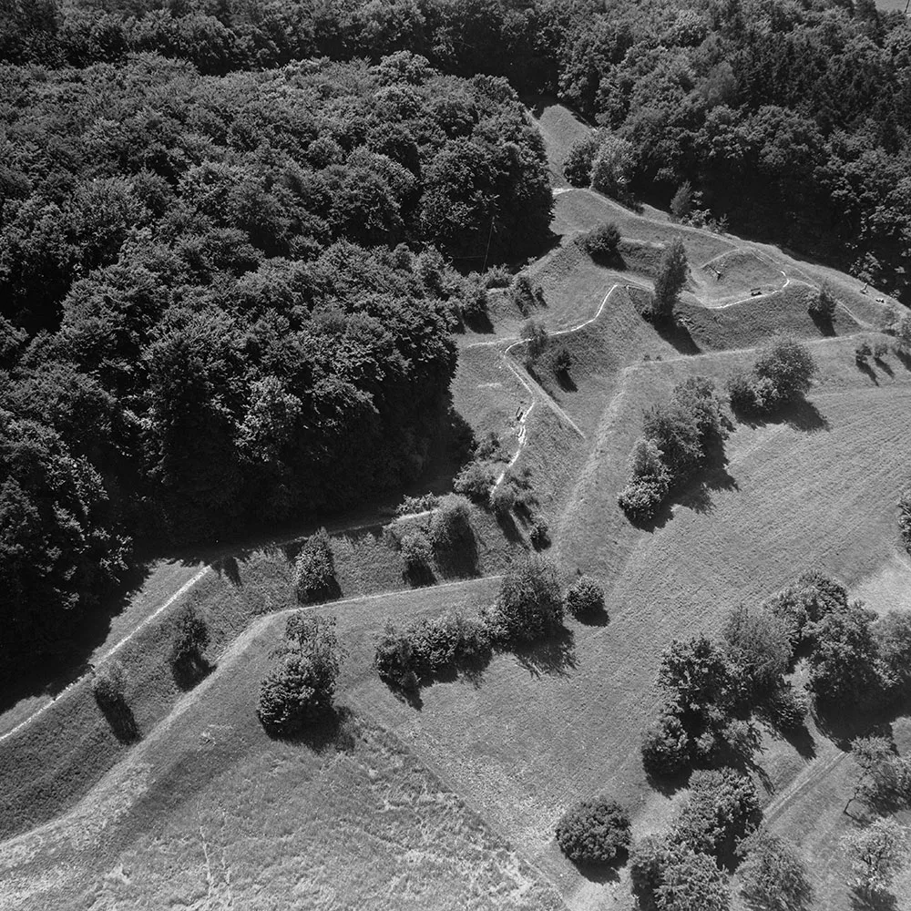
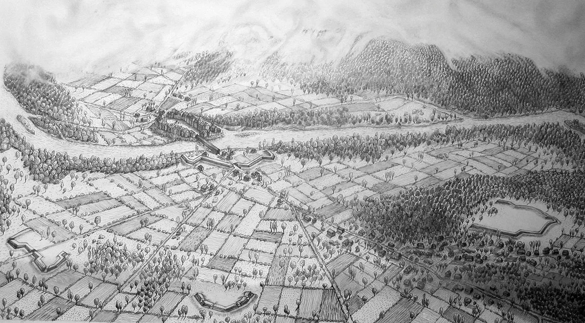
A brief guide to fortress building

Bastion: Part of a fortification projecting outward from the straight curtain wall that can defend the area immediately in front of the wall. Bastions have a similar role to the earlier defensive towers of a castle.
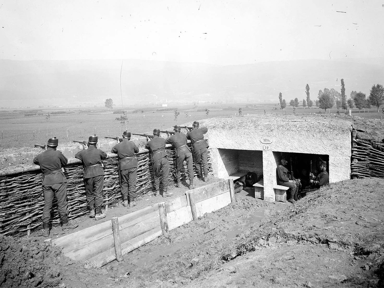
Breastwork: A temporary fortification built to breast height to provide protection to defenders from enemy fire.
Curtain: Straight section of rampart or wall connecting two bastions.
Hornwork: Horn-shaped fortification that blocks the flow of traffic through the curtain wall.
Lunette: Small, independent fortification that is usually open to the rear.
Redoubt: An enclosed fortification constructed to defend a position from attack from any direction.
Tenaille: A fortification without bastions but with a wall consisting of alternating salient and re-entrant angles.
Dufour was responsible for staking out the planned structure on the site. The planning and design of the bridgehead thus attest to the future General’s engineering skill. To save costs, it was already decided during the initial planning stage that only three fortifications should be built. They would all be located in front of the central redoubt of the bridgehead dating back to 1815. Dufour and his entourage opted for the absolutely essential fortification on the Bargenhügel, a hornwork on Bielstrasse (Kappelen fortification) and an intermediate lunette (Murten lunette, also known as ‘Schärpeter’) in the middle of the two. The three fortifications could flank each other.
The plan of the ‘Aarberg fortifications’ of 1831 bears Dufour’s signature. The fortifications circled in yellow were never built.
The plan of the ‘Aarberg fortifications’ of 1831 bears Dufour’s signature. The fortifications circled in yellow were never built. Swiss Federal Archives
The fortifications built in Aarberg in 1831 were simple fieldworks. The earth excavated from the fortification ditches was heaped back to serve as a breastwork. From the protection of the wall, soldiers could then fire using rifles and cannons. For example, the Bargen fortification had an upper trench width of 5.4 metres, and the adjoining wall had a height of 2.4 metres. This wall encircled the uppermost section of the Bargenhügel hill. Ten cannons were planned for the Bargen fortification. In the event of an attack, the plan was to fell the trees in front of the walls, thereby creating an additional obstacle ahead of the position.
The Kappelen fortification, which was also designed for ten cannons, was located 1,100 metres from the river crossing. The road from Biel to Nidau ran through the curtain wall. It was flanked by two bastions on either side and the hornwork was designed to block this transport route if necessary. To connect the two fortifications, Dufour had the Murten lunette built in an open field.
This reconstruction drawing shows a bird’s eye view of the fortifications of Aarberg circa 1831. The roads from Murten, Neuchâtel and Biel converged in front of the small town of Aarberg and the bridgehead dating from 1815.
This reconstruction drawing shows a bird’s eye view of the fortifications of Aarberg circa 1831. The roads from Murten, Neuchâtel and Biel converged in front of the small town of Aarberg and the bridgehead dating from 1815. Drawing: Claudia Jordi, Bern, 2008
The Bargen and Kappelen fortifications were built between late April and mid-June 1831. Fifty men from a Zurich combat engineering company worked as expert foremen, and around 800 day labourers worked on the construction sites in Aarberg. The construction costs amounted to 24,000 Swiss francs (approximately three million Swiss francs today) in the federal military expenditure of 1831. By the end of September of that year, the situation in Europe had eased. Clearly, however, the threat of an attack from the west still loomed. At the end of 1831, the Swiss Confederation bought up the fortified plots for 12,500 Swiss francs.

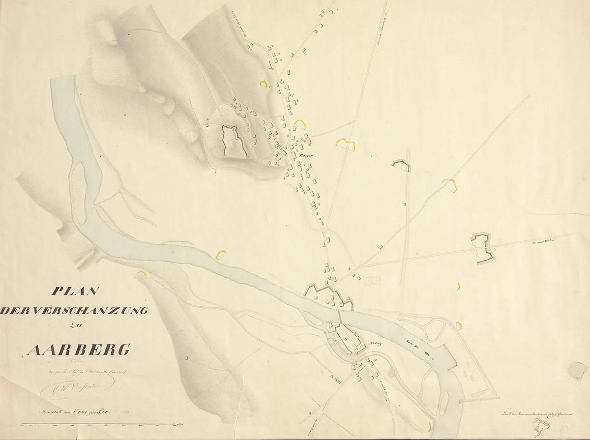
Construction work in the 1870s

The land on which the bridgehead of 1815 stood was bought by the Confederation in 1857. The structure no longer features on the Dufour Map of 1845. However, the location of the first Swiss fortification can be guessed from the road layout on current maps and aerial photos. From 1875, work was started on the Hagneck canal, the centrepiece of the first Jura waters correction. The construction of the canal had a detrimental effect on the fortifications, which led to the defensive structures being reassessed, starting in 1870. The chief engineer at the time, Jules Dumur, had various construction work carried out in Aarberg in 1875. The Bargen fortification was filled with excavation material and the new Hagneck canal cut into the Murten lunette. The army used the excavation material from the canal to convert the fortification into an enclosed redoubt, thereby completely transforming the layout of the work. In the late 1870s, the troops built another fortification on the Hagneck canal directly, around 1,200 metres to the west of the Murten lunette. This is located on the area that today bears the place name ‘Golsreiner’.
Portrait of Jules Dumur, circa 1880.
Portrait of Jules Dumur, circa 1880. Wikimedia / Bibliothèque nationale de France
In the late 19th century, the Aarberg region and its field fortifications became less important. Artillery technology had made huge progress. Rudimentary earthworks offered barely any protection against the new projectiles. In addition, the first Jura waters correction had a significant impact on the region’s military geography. And Aarberg lost its importance as a transport hub. The shortest and most direct connection between France and Bern then passed through the Val de Travers via the Zihl canal between Lake Neuchâtel and Lake Biel. Since the lowering of the water level, the ‘Grosse Moss’ (great marsh) – which had previously served as a barrier, had become easier to cross. The area between the three Jura lakes therefore replaced Aarberg as a key strategic location. The Murten fortifications took over the role of defending Switzerland against an attack from the west in 1914–18. The Bargen fortification and the ‘Schärpeter’ Murtenlunette have for the most part been conserved, while the Kappelen fortification was demolished after the Second World War.
Aerial photograph of the fortification in Kappelen, 1946. It was dismantled soon afterwards.
Aerial photograph of the fortification in Kappelen, 1946. It was dismantled soon afterwards. swisstopo
In 1950 the fortification in Bargen already blended into the natural vegetation.
In 1950 the fortification in Bargen already blended into the natural vegetation. e-pics

Further posts